New Zealand's volcanoes
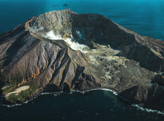
Our volcanoes are world re-nowned, both in frequency of eruptions and volumes of material ejected.
Overview of New Zealand's volcanoes
Most New Zealand volcanism in the last 1.6 million years has occurred in the Taupō Volcanic Zone (TVZ) which extends from Whakaari/White Island to Ruapehu.
Other volcanoes include Raoul Island, Auckland Volcanic Field, Okataina, Taranaki and Tongariro.
-
Raoul Island
Raoul Island is the northernmost Kermadec island around 1,000 km north-north-east of New Zealand, and is one of its most explosive and potentially destructive volcanoes. It is the largest of the Kermadec islands and has two active calderas about 3 km and 6 km across. Sometimes they have erupted simultaneously in historic times.
Most Recent Eruption
On 17 March 2006 following a strong sequence of earthquakes the previous week, Raoul Island erupted without warning at around 8:20 in the morning. Rocks and mud were ejected from the Green Lake area and equipment on the island showed the eruption continued for around 30 minutes. Scientists believe the eruption was caused by shaking of an existing magma chamber beneath the island by a nearby earthquake swarm. The shaking caused a sudden release of volatiles from the existing magma which accumulated beneath a sealed hydrothermal system until the pressure was great enough to blow the seal and cause the eruption. Tragically, a Department of Conservation employee was killed by this eruption.
-
Auckland Volcanic Field
The Auckland Volcanic Field is made up of 53 volcanic centres scattered across New Zealand's largest city. The style of volcanic activity in Auckland means each eruption has occurred at a new location; the eruptive centres feed from a potential zone of partial melt about 70-90 km below the city. Many of the volcanoes today have been quarried or become public parks. Auckland’s existing volcanoes are unlikely to become active again, but the Auckland Volcanic Field itself is young and still active. An eruption in the Auckland Volcanic Field is a low probability event on human timescales but would have high consequences.
Most Recent Eruption-
Of all Auckland’s eruptions, Rangitoto was the only one witnessed by people. The eruption, around 600 years ago, would have been extremely violent, as the lava came into contact with sea water. Of note, Rangitoto alone produced a volume of lava equal to that erupted by the rest of the volcanoes in the volcanic field.
-
-
Whakaari/White Island
Whakaari/White Island is currently New Zealand’s most active cone volcano, sitting 48 kilometres offshore. The cone has been built up by continuous volcanic activity over the past 150,000 years. The island covers an area of around 325 hectares and this is only about 30 per cent of the volcano’s mass - the rest is under the sea. Even so, it is only about half the size of other cone volcanoes like Mount Ruapehu, Tongariro or Taranaki.
2019 Explosive Eruption
A fatal explosive volcanic eruption from vents in the 1978/90 Crater Complex occurred at 2:11pm on Monday 9 December 2019. Tragically some visitors and guides on the island at the time were killed, and many injured. The eruption removed the crater lake, formed new vents and generated landslides into the active crater area.
GeoNet - Whakaari/White Island Frequently Asked Questions(external link)
-
Tūhua/Mayor Island
Tūhua, also known as Mayor Island, holds deep ancestral significance as the home of Te Urungawera, a hapū of Te Whānau a Tauwhao (Ngāi Te Rangi). Geologically, Tūhua is a collection of overlapping volcanic shields and pumice cones, and several collapse calderas, situated 28 km northeast off Waihi Beach and 40 km north from Tauranga on the Bay of Plenty coast. The island we see is the volcano summit, measuring about 600 m in height from seafloor to summit and 6 km in diameter under the water. Tūhua serves as a wildlife refuge, overseen by the Tūhua Trust Board.
Eruption history
From our current knowledge and research, Tūhua/Mayor Island last erupted around 2,000 years ago and has had at least 31 eruptions in the past 54,000 years, with large eruptions every 7,000 to 8,000 years. The largest eruption was around 7,200 years ago, which deposited tens of centimetres of ash on the mainland, with other large eruptions around 14,000 and 35,000 years ago.
Tūhua/Mayor Island is a dormant volcano, meaning it is not currently active or restless, but could erupt again. An eruption is considered unlikely within our lifetimes.
See the fact sheet on Tūhua/Mayor Island (PDF, 3.1 MB)GeoNet(external link) constantly monitors the island and will provide updates on any change in activity.
Visit the Beneath the Waves programme website(external link) for more information.
How Auckland Volcanoes Erupt – There are over 50 volcanic cones and craters in Auckland New Zealand. Dr Ian Smith explains how they erupt, and the rocks that they produce.
How Auckland Volcanoes Erupt
There are over 50 volcanic cones and craters in Auckland New Zealand. Dr Ian Smith explains how they erupt, and the rocks that they produce.
-
Okataina
The Okataina Volcanic Centre includes Tarawera, source of the most lethal eruption in New Zealand's recorded history. The Okataina Volcanic Centre extends from Lake Rotoma in the north to Waiotapu in the south. It includes the large, young volcanoes of Tarawera and Haroharo, with others at Okareka and Rotoma. More than 35 vents have been active at Okataina during the last 21,000 years.
Most Recent Eruption
On 10 June 1886, the Tarawera eruption began at 1.30am and lasted about 5 hours. Witnesses described earthquakes, lightning storms and fireballs, strong winds, suffocating gases, ash fall and darkness during daylight hours as the ash cloud passed overhead.
A 17 km long rift was blasted across the top of the mountain, through Lake Rotomahana and into the Waimangu Valley area. A mixture of steam and finely fragmented rock known as the ‘Rotomahana Mud’ spread over a wide area and was heavy enough to collapse nearby buildings. The world famous Pink and White Terraces were destroyed, and more than 100 people were killed in villages near the mountain. The ‘Buried Village’ of Te Wairoa has been excavated from the rocks, ash and mud which buried it in 1886.
-
Taupō Volcano
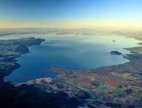
Lake Taupō is a large caldera volcano, a special type of volcano that has rare but unusually large eruptions. 29 eruptions have occurred from Taupō volcano in the last 30,000 years, the most recent about 1,800 years ago. Three of the eruptions have been very large, however, 26 have been much smaller eruptions, forming lava domes or spreading pumice and ash over nearby areas.
Most Recent Eruption
-
The Taupō Eruption was about 1,800 years ago and was the most violent eruption in the world in the last 5,000 years. It was a complex series of events. The first phases of the eruption produced a series of five pumice and ash fall deposits over a wide area of the central North Island, especially east of Taupō and beyond Napier into Hawke Bay. The eruption culminated with a large and very energetic pyroclastic flow that devastated an area of about 20,000 km2 and filled all the major river valleys of the central North Island with pumice and ash. These pumice deposits can still be seen today and many of the major rivers in the North Island carry large amounts of this pumice when in flood. Rounded pumice found on the beaches of the North Island have come from this eruption. The Taupō eruption took place from a line of vents near the eastern side of the modern lake.
-
Taupō Volcano Unrest – Sally Potter shows how unrest under Taupō Volcano has been quite common over the last 140 years.
Taupō Volcano Unrest
Sally Potter shows how unrest under Taupō Volcano has been quite common over the last 140 years.
-
Taranaki Maunga
This classically shaped symmetrical peak stands in isolation to the west of the Central North Island volcanoes. At 2,518 metres high, Taranaki Maunga is the second highest peak in the North Island after Ruapehu, and is New Zealand’s largest mainland volcanic cone by volume.
The volcano last erupted about 150 years ago at the culmination of several eruptions in the preceding few hundred years. The western 1500 km2 of the Taranaki region is a volcanic landscape that has been constructed from the products of volcanic eruptions principally derived from the volcano. These deposits around the base of the volcano record intermittent volcanic activity at this site for the last 130,000 years.
Most Recent Eruption
-
Around 1854 there was a minor explosive ash eruption from Taranaki maunga. The last major eruption was around 1655 AD.
Taranaki Infographics Series from Taranaki CDEM(external link)
-
-
Tongariro
Tongariro is a massive complex of volcanic cones and craters formed by eruptions from at least 12 vents over more than 275,000 years. Erosion during the last Ice Age has worn away what was once a substantial mountain into the world famous hiking destination that it is today.
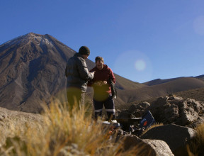
Ngauruhoe is the largest, youngest and most active cone (2291m high) of the much larger Tongariro Volcano complex and last erupted in 1975.
Most Recent Eruption
Tongariro erupted twice in 2012 (6 August and 21 November) at Te Maari Crater.
-
Ruapehu
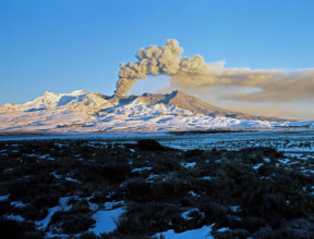
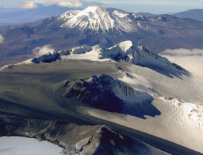
At 2797 m, Ruapehu is the highest mountain in the North Island and the largest active volcano in New Zealand. It is located at the southern end of the Taupo Volcanic Zone. Three summit craters have been active during the last 10,000 years including South Crater which contains the currently active vent. The active vent is filled by Crater Lake; water from this lake is frequently ejected on to the ice and snow during eruptions causing lahars.
Ruapehu is a stratovolcano (composite cone volcano) made of successive layers of andesite lava and ash deposits. The mountain is surrounded by a ring plain of volcanic material from lahars, landslides and ash falls.
Most Recent Eruption
On 25 September 2007 there was an explosive eruption, lasting about 7 minutes. During the eruption explosions spread ash, rocks and water across the summit area, producing lahars in two valleys including one in the Whakapapa ski field. In contrast with the previous eruptions in 1996, there was no high ash plume to produce ash fallout over a wide area.
