Our Plate Boundary
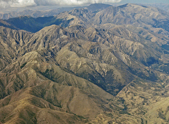
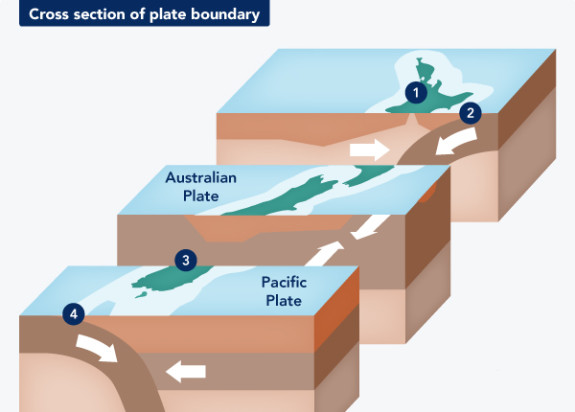
Aotearoa New Zealand is positioned astride the active Pacific-Australian plate boundary.
Our continent's position provides an ideal natural laboratory for a global community of researchers to better understand processes that control natural hazards.
GNS Science drives our work in this area through our Te Riu-a-Māui Zealandia SSIF programme. This research investigates the geological processes that formed and evolved the continent beneath our feet. It covers all work on the plate boundary with a focus on the Hikurangi Subduction Zone, which is characterised by high and unknown risk.
Our research
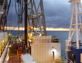
We investigate and model the crustal structure, deformation mechanisms and processes in and near the modern Pacific-Australian plate boundary that transects Te Riu-a-Māui Zealandia.
Our main emphasis is on the Hikurangi subduction zone where we find a spectrum of plate boundary slip processes, including steady creep, episodic slow slip events, and seismic (stick-slip) behaviour. We focus our research on:
- Understanding the transition from subduction to collision
- Understanding the role of the Alpine Fault in New Zealand tectonics and earthquake occurrence
- Using exhumed, ancient analogues to better understand modern plate boundary processes
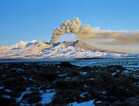
We also focus our research on how volcanism and geothermal properties have been shaped by our continent's unique movement due to the plate boundary processes happening underneath.
Model of Magnitude 8.9 Hikurangi Earthquake and Tsunami transcript
Leading New Zealand scientists have designed a credible scenario for an earthquake and tsunami on the Hikurangi Subduction Zone.
The scenario, further developed by GNS Science experts, helps emergency responders to plan and prepare for a magnitude 8.9 earthquake and tsunami on the Hikurangi Subduction Zone which is off the east coast of the North Island.
The scenario shows impacts from the earthquake and tsunami for the most effected areas across the North Island's East Coast in New Zealand.
It is one of many possible scenarios and does not predict the future. It is unlikely that a Hikurangi Subduction Zone earthquake and tsunami will happen exactly like this.
This scenario is based on a magnitude 8.9 earthquake and shows the potential levels of ground shaking. The earthquake's rupture begins 70 kilometres off the coast Porangahau, Hawke's Bay at a shallow depth of nine kilometres.
An earthquake like this would release around 45 times more energy than the 2016 magnitude 7.8 Kaikoura Hurunui earthquake.
The scenario is run at double the actual speed and the scale bar shows the level of shaking. White shows extreme shaking and red shows strong to severe shaking.
The earthquake rupture continues north and south creating long and strong shaking along the east coast of the North Island.
Gisborne would experience particularly strong and long shaking in this scenario due to the different rock types in the area that increase the shaking's intensity and duration.
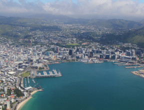
Wellington would feel ground shaking 90 seconds after the initial earthquake rupture.
Areas further away from the earthquake rupture would experience strong shaking. For example Auckland though a good distance away would experience around 30 seconds of severe shaking.
As well as the shaking the earthquake would potentially cause liquefaction, landslides and fires in some areas.
The sudden movement of the sea floor during the earthquake causes a lot of water to move creating a tsunami.
The scenario is now showing the tsunami created by this large earthquake. Within the first few minutes there are rapid changes in sea level along the east coast of the North Island.
The tsunami moves in all directions.
After the earthquake rupture some parts of the coast may see a rise in sea level shown in red. In others such as Hawke's Bay in this scenario the sea-level would rapidly decrease, pulling away from the coast and returning with enormous speed and force when the tsunami waves arrive. This is shown in blue.
This is because the ocean first draws down and sucks water away from the coastlines to later return.
Close to the shore along the East Coast waves could reach about ten metres above normal sea level in some places. In a few locations where the tsunami is funnelled into steep valleys on shore it might reach even higher, possibly up to 20 metres above sea level.
In some other earthquake scenarios run-up heights could be even greater than 20 metres at some locations. Tsunami evacuation zones account for multiple possible earthquake scenarios.
In this scenario the speed the tsunami waves travel means there would not be enough time for an official evacuation warning.
The long or strong earthquake is your signal to self-evacuate all tsunami evacuation zones.
Check your tsunami evacuation zones on your local civil defense group website.
Make sure that you and your family and others who rely on you know your evacuation route to higher ground or inland whether you're at home, at work, at school or out and about.
In this scenario around 13 minutes after shaking begins in Wellington large tsunami waves arrive at the harbour entrance and extend into the tsunami evacuation zones. It's important to evacuate all tsunami evacuation zones in a long or strong earthquake.
The scenario is sped up to show how the tsunami moves in the first two hours of the earthquake.
The tsunami would reach cities as far away as Auckland, Christchurch and even the West Coast of the North Island.
While this and other science-based scenarios do not predict the future and a single scenario
cannot provide all the answers on its own, they help emergency managers to plan and prepare for events like a Hikurangi subduction zone earthquake and tsunami.
To get prepared visit getready.govt nz
To check your tsunami evacuation zones visit your local civil defense emergency management website.
Model of Magnitude 8.9 Hikurangi Earthquake and Tsunami
This scenario helps emergency responders to plan and prepare for a magnitude 8.9 earthquake and tsunami on the Hikurangi Subduction Zone.
Key questions driving our research
- Why, when and where do large plate boundary earthquakes happen?
- How are stress and strain distributed across the plate boundary?
- How do volcanism and geothermal systems in Aotearoa New Zealand link to magma, heat production and crustal fluid circulation?
- How do we develop model-informed monitoring and future-focused data acquisition networks across all our hazards, environments and energy risks?
- How can we better detect and provide warnings for tsunami generated from all sources including earthquakes, submarine landslides, tsunami earthquakes and volcanic edifice collapse?
- What role do Earth's surface and sea floor processes play in defining the changing dynamics of Aotearoa New Zealand's landmass?
