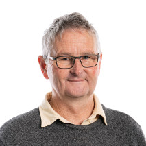
Mark RattenburySenior Geologist

Biography
Specialist in geoscience information, particularly geological map-based, with experience field mapping igneous and metasedimentary basement terranes in the South Island, Antarctica and Australia. Applies geological knowledge to support research into tectonics, basement geology and surface geochemistry and to support New Zealand resource exploration and infrastructure. Led major research programmes including the QMAP Geological Map of New Zealand (2004-2012), Minerals, Urban and Regional Geology (2012-2017) and Nationally Significant Databases and Collections (2017-2024). Continues to compile and enhance geological map products under the Regional Geological Map Archive and Datafile. Actively involved in national and international research data groups including CGI-IUGS Council and its Geoscience Terminology Working Group. Advocates for FAIR Principles adoption and better practice Māori data governance within and outside of GNS Science.
Qualifications
- PhD, Geology
- MSc Hons, Geology
- BSc, Geology
Areas of expertise
- Geology: Geological mapping
- Geology: Regional Geology
- Geology: Data management
- Geology: Database Design
- Geology: Geoscience information
- Geology: 3D geological modelling
- Geology: New Zealand Geology
- Geology: GIS mapping
- Geology: Stratigraphy
- Information Technology: Geoscience data standards
Publications
Selection of major publications
- Zealandia: Earth's hidden continent, GSA today 27(3): p. 27-35. DOI: 10.1130/GSATG321A.1. p. 27-35
- High-level stratigraphic scheme for New Zealand rocks, New Zealand Journal of Geology and Geophysics 57(4): p. 402-419. DOI: 10.1080/00288306.2014.946062. p. 402-419
- Geology of the Haast area : scale 1:250,000 Lower Hutt: GNS Science. Institute of Geological & Nuclear Sciences 1:250,000 geological map 14 58 p. + 1 folded map
- Geology of the Kaikoura area : scale 1:250,000 geological map Lower Hutt: GNS Science. Institute of Geological & Nuclear Sciences 1:250,000 geological map 13 70 p. + 1 folded map
- Geology of the Greymouth area : scale 1:250,000 Lower Hutt: Institute of Geological & Nuclear Sciences. Institute of Geological & Nuclear Sciences 1:250,000 geological map 12 58 p. + fold. map
- Geology of the Nelson area : scale 1:250,000 Lower Hutt: Institute of Geological & Nuclear Sciences Limited. Institute of Geological & Nuclear Sciences 1:250,000 geological map 9 67 p. + fold. map