Announcing new research for New Zealand's resilience

GNS Science to receive $22.165M from the 2024 Endeavour Fund for resilience-related research.
The three new projects will help future-proof New Zealand's water and improve forecasting for landslides and volcanic ash.
Future-proofing groundwater systems
The problem: Groundwater sustains lives and livelihoods, yet we currently have few tools to effectively manage it. The quantity and quality of Aotearoa New Zealand’s groundwater is declining, while demand for this vital resource is increasing – a problem that is projected to worsen due to climate change. To protect our groundwater resources and adapt to changes in climate and land use, we urgently need to better understand groundwater systems and develop new strategies to manage and protect them.
The solution: This programme will advance understanding of groundwater resilience through new characterisation and modelling approaches, and develop adaptive management tools to secure freshwater health, while supporting the primary sector under a changing climate.

The tools developed will ensure sustainable drinking water supply and quality, improve the health of our surface water systems, safeguard irrigation provision, and identify water allocation options for both environmental and economic benefits
"Our multidisciplinary team will develop the world’s first agile groundwater management framework, taking into account change and uncertainty in groundwater systems and involving communities in decision making," says Dr. Moore.
Our collaborators: Lincoln Agritech, the British Geological Survey, Watermark Numerical Computing (Australia), Intera (USA), Deltares (Netherlands), University of Adelaide (Australia), NIWA, Aqualinc, Land Water People, Scarlatti, Te Herenga Waka – Victoria University of Wellington, and the University of Victoria (Canada).
The project has been awarded $10,407,101.00 through the Endeavour Research Programme fund to be conducted over a term of five years.

Landslide Watch Aotearoa
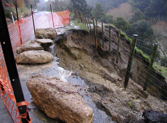
The problem: Cyclone Gabrielle demonstrated that our homes, livelihoods, wāhi tūpuna, and lives are increasingly vulnerable to the impact of landslides. If we can detect some of the slopes capable of damage, and understand what drives their movement, we can inform building/infrastructure development, prepare our communities, and mitigate landslide impacts before they occur.
The solution: The programme aims to move away from expensive local reactive (post-event) in-situ monitoring to pro-active (pre-event) space-based observation across all Aotearoa. This ambitious approach will enable landslides to be identified nationwide, link their movement patterns to climatic drivers, and characterise their behaviour before they cause damage.
Programme co-lead Dr Chris Massey says "For many people, their house is not only their home, but their largest investment. Increasing our capability to assess locations and forecast movement of slow-moving landslides will aid in identifying areas vulnerable to landslide hazards, enhancing informed urban development, community preparedness and the economic resilience of New Zealand and New Zealanders.”

Slow-moving landslides can remain an undiscovered threat for generations. However, with the intensifying frequency of high-rainfall events serving as a trigger for landslide reactivation, acceleration, and slope failure, the danger these hidden landslides pose is becoming ever clearer
"Uncovering these landslide hazards will help us adapt to our changing climate by making more informed decisions on where to build, buy, insure, invest, and make existing infrastructure more resilient to landslides,” adds Dr. Hamling.
Our collaborators: NIWA, University of Waikato, University of Canterbury, University of Leeds (UK), University of Oregon (US), University of California (US), University of Washington (US) and the Disaster Prevention Research Institute, Kyoto University (Japan).
This project has been awarded $10,593,791.00 through the Endeavour Research Programme fund to be conducted over a term of five years.

Next-generation ash dispersal forecasts
The problem: Ash from explosive volcanic eruptions can harm human and animal health, damage critical infrastructure and aircraft, and kill crops. During eruptions, accurate and rapid ash dispersion and ashfall forecasts can help inform impact assessments and enable emergency and infrastructure managers make critical decisions to protect New Zealanders from these harmful ash impacts.
The solution: This research seeks to leverage existing real time data sources and combine them with numerical models in a novel way to rapidly and dynamically constrain eruption source parameters (ESPs) – such as plume height, eruption rate and duration – and their associated uncertainties. Testing new methods with data from past eruptions will address the question “How fast can accurate ash forecasts, based on measured ESPs, be created during an eruption?”

Accurately forecasting where the ash will disperse depends on being able to rapidly measure eruption properties, such as the plume height or the emission rate of ash.
“We aim to develop methods for rapidly measuring these eruption properties, to produce faster and more reliable ash transport forecasts. This will enable quicker and better-informed decision making, reducing impacts on communities and support faster recovery from damaging volcanic eruptions," says Dr. Jarvis
Our collaborators: MetService, Massey University researchers, CSIRO (Australia), L'Université Clermont Auvergne (France), Civil Aviation Authority, NEMA and Neo Leaf Global.
This project has been awarded $1,000,000 through the Endeavour Smart Ideas fund to be conducted over a term of three years.