
Celebrating 20 years of GeoNet
In July GeoNet will hit a ground-breaking milestone as it turns 20 years old.
That’s two decades of growing the network, building data sets, increasing monitoring capabilities and improving awareness of the geohazards we live with here in Aotearoa New Zealand. GeoNet was founded in 2001 as a collaboration between the Earthquake Commission (EQC), GNS Science and Toitū Te Whenua Land Information New Zealand (LINZ). Originally GeoNet started as a provider of high quality and timely data, supporting emergency management and scientific research. Since then it has grown into a household name with more than a quarter of a million Kiwis using the GeoNet App to access data from our geohazard monitoring.
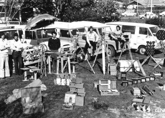
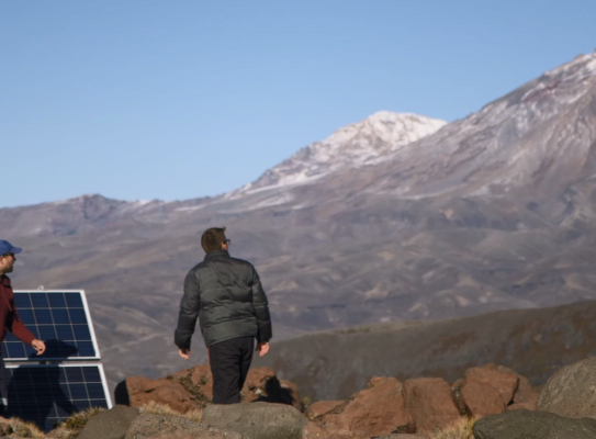
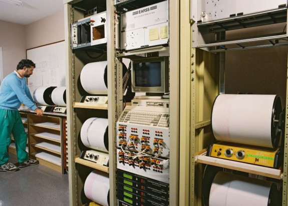
Prior to GeoNet, earthquake location could take weeks. Now it’s done in minutes. Like any maturing 20-year-old, GeoNet has gained more responsibility and embraced future technology. In 2018, GNS opened its Geohazards Monitoring Centre with the support from MBIE and MCDEM (now NEMA). The data collected by the GeoNet network (sensors, cameras, gauges etc) informs GNS’s science and enables our 24/7 monitoring of earthquakes, volcanoes, landslides and tsunami. It helps us understand more about what’s happening and allows us to provide crucial insights and support to emergency management agencies, allowing them to make informed decisions planning for and responding to geohazard events.
We are pretty unique in the world in terms of monitoring earthquakes, volcanos, landslides and tsunami under one roof… I’m really proud that as a country we are there to help New Zealanders to stay safer.
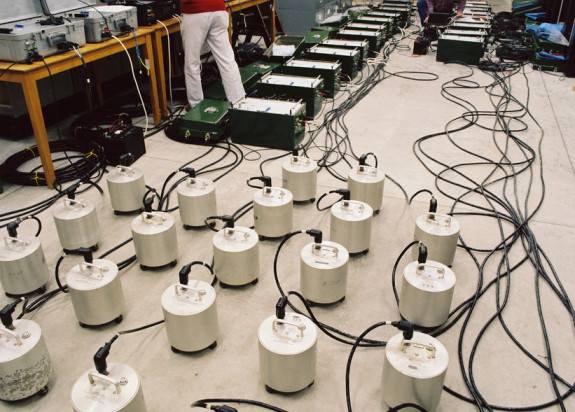
GeoNet’s network includes over 1,000 instruments. In the past 12 months, it has detected more than 23,000 earthquakes. We believe GeoNet is now a vital piece of Aotearoa New Zealand’s infrastructure.
And as impressive as the growing network is, GeoNet isn’t just about the instruments and the data – we’re equally proud of the people at GNS Science who bring this network to life. Their monitoring, maintenance and interpretation has led to a world-leading system that contributes to a safer and more resilient Aotearoa New Zealand.
So, a big warm thank you to our founders and partners: Toka Tū Ake EQC, MBIE, LINZ and NEMA. We thank all the scientists, researchers and data users. We’d like to give a special shout out to all our GeoNet teams (past and present) - the people and communities who host our equipment. Together, you have all made this amazing network possible.
Keep an eye out on our social media over the course of the year for stories and more as we celebrate 20 years of collaboration and progress.
And if you haven’t already, make sure you download the official GeoNet App to keep your finger on the pulse of our beautiful and dynamic country. Available on Android and iOS.
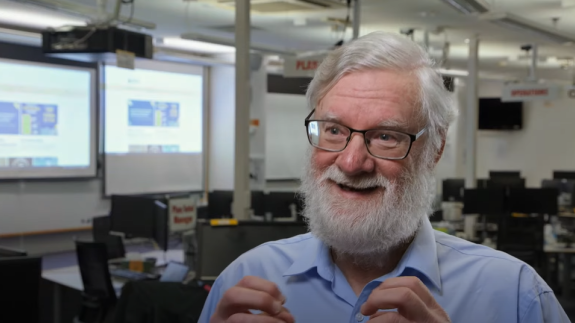
Check out the video below to hear how GeoNet partners, team members and data users would describe GeoNet in one word.
GeoNet In One Word | 20 Years Of GeoNet transcript
One word to describe GeoNet?
Hmmm, I'll have to think about this one for a little bit.
Unique.
Teamwork.
That was a tough one.
I don't have one word.
Innovative.
I would say, knowledge.
Data.
Data.
Data.
It's exciting!
Does it have to be one word? [laughter]
Public good.
Infrastructure.
Yeah, GeoNet is awesome.
Inspiring.
I'm not sure I can do it in one word!
[laughter]
One word?
An enabler.
Needed.
Trusted.
Necessary.
Awesome!
So to me the word GeoNet means "earthquake", and I'm sorry about volcano, landslide, and tsunami, but
it's in the public's brain that GeoNet equals "earthquake".
Multi-faceted, it's innovative.
So I looked up "net" on Māori dictionary.
It's described in te ao Māori as a means to collect things.
When I look at what GeoNet is, it is a collection of data that sits here and informs us.
GeoNet in one word, I'll go with "science", because our data underpins scientific breakthroughs and
science informs everything we're trying to do to help New Zealand understand its geological place.
I can't do it in one, I'll do it in three.
It's foundational critical infrastructure.