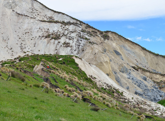
Landslide risk to properties 50 percent more accurate with new technique

Earthquakes are powerful ground shaking forces that can trigger large numbers of slips.
A new technique developed by GNS scientists using advanced remote sensing technology is more accurately and cost-efficiently estimating individual landslide volumes.
The Kaikōura earthquake triggered 30,000 landslides that mobilised 241 million cubic metres of rock and debris – enough to fill 96,400 Olympic-sized swimming pools!
Knowing landslide volumes can help model how far a landslide will runout down a slope and the damage the debris can cause properties downhill. For the environment, it can estimate the amount of landslide sediment transported down rivers, which can damage aquatic life, put river infrastructure at risk, and increase the flood likelihood due to sedimentation within the riverbed along with shifting of the riverbed channel.

The new technique, described in a recent Landslides (external link) journal paper by GNS lead author Dr Katie Jones, illustrates how advanced remote sensing technology such as LiDAR and aerial photography can be used to accurately and cost-efficiently estimate individual landslide volumes.
Dr Jones said landslide volume was thought to scale with the size (area) of the landslide.
"Typically, the larger the landslide area, the larger the volume. And that’s important because the larger the landslide volume, typically the longer the runout and the more damage it can do," Dr Jones says.
-
What is LiDAR
LiDAR, which stands for Light Detection and Ranging, is a technology used to quickly and accurately create high-resolution models of 3D features from the world around us, including buildings, vegetation, and the ground. The technology measures the two-way travel time of a laser light pulse to determine distances of objects or features on Earth's surface.
This new piece of research shows that landslide volume is highly variable – some landslides are large but shallow, whereas others are small but deep. By being able to better predict volume, we can use this information to more accurately model landslide impacts to urban properties.
-
Paper co-authors
Jamie D. Howarth, Victoria University of Wellington
Chris I. Massey, GNS Science
Biljana Luković, GNS Science
Pascal Sirguey, University of Otago
Corinne Singeisen, University of Canterbury
Caleb Gasston, Auckland University
Regine Morgenstern, GNS Science
William Ries, BOKU University, Vienna -
Research acknowledgements
This study was funded by the New Zealand Governments Ministry of Business, Innovation and Employment’s Endeavour fund as part of the work carried out for the Earthquake Induced Landscape Dynamics (EILD) program.
We acknowledge the GeoNet program, the New Zealand Natural Hazards Research Platform, and Land Information New Zealand (LINZ) who funded the initial response and aerial surveys to capture landscape change, which were greatly valued in this study.