Latest calculations show “medium likelihood” of Whakaari/White Island eruption
There is a “medium likelihood” of an eruption outside the vent area of Whakaari/White Island, with volcanic tremor increasing, GNS Science experts say.
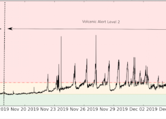
Scientists reviewed all available data this morning and calculated a 40-60% chance of an eruption in the following 24 hours that would impact beyond the vent area.
For comparison, an assessment made on 29 October 2019 (at Volcanic Alert Level 1) calculated an estimated 0.1 – 0.2% chance of an eruption.
GNS Science duty volcanologist Craig Miller says volcanic tremors have increased since this morning.
“Our monitoring equipment continues to function and is providing us with continuous data on the volcano’s activity,” Craig Miller says.
“The latest data shows ground shaking is increasing.
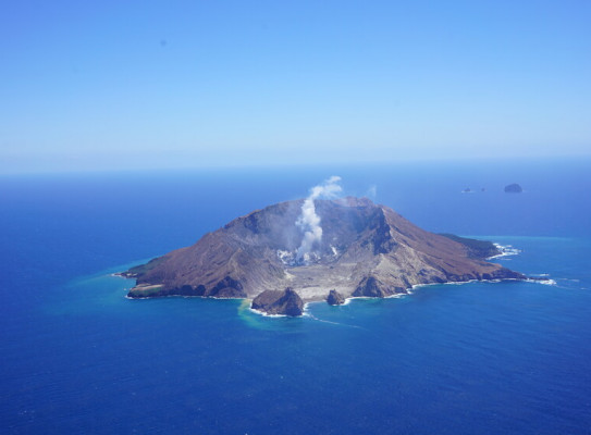
It’s important to remember Whakaari/White Island is New Zealand’s most active volcano, and there remains significant uncertainty about any future activity.
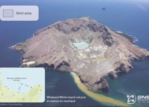
Volcanic Alert Level remains at Volcanic Alert Level 3 (minor local eruption).
“This refers to volcanic activity – not impact,” Craig Miller says.
“Minor eruptions can still have tragic consequences, as in this case.”
GNS Science experts are providing up-to-date information to both National and Regional responding agencies, and updating the public (and media) via the Volcano Alert Bulletins.
Our thoughts are with the families and friends of the people who lost their lives in Monday’s eruption, and all those involved in the recovery and response effort.
More information will be provided by GNS Science at the 5:00pm National Emergency Management Agency (NEMA) and New Zealand Police press conference.