Living on the edge: Monitoring the Motu
Aotearoa New Zealand has a unique geographical and geological place in the Pacific, along the collision zone of two of the Earth’s major tectonic plates, the Pacific and the Australian. It gives us our stunning landscape, but also puts us at risk from natural hazards such as earthquakes, tsunami, volcanoes, and landslides.
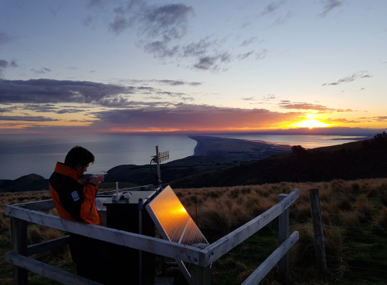
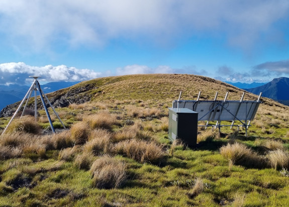
Helping to keep us all safe is a network of 9,100+ monitoring instruments and supporting equipment in more than 700 locations across Aotearoa New Zealand and the Southwest Pacific - in lighthouses, on farmland, under oceans and lakes, up mountains, and even on active landslides. GNS monitors the four geological hazards 24/7, every day of the year, alerting us to impending events, supporting emergency response activity and informing research.
Over time, New Zealand’s capacity and capability to monitor, measure, respond to and mitigate hazards has improved greatly with advancing global technology and continued strong partnerships with our sponsors - Toka Tū Ake EQC, Toitū Te Whenua Land Information New Zealand, Ministry of Business Innovation and Employment Hīkina Whakatutuki and the National Emergency Management Agency Te Rākau Whakamarumaru.
Just 22 years ago, GeoNet(external link) launched with 102 land-based sensors, gathering data primarily for research. Fast forward to 2023 and we have a 24/7 monitoring centre keeping eyes on more than 800 instruments, each supported by a raft of technology that serves to relay the data being collected. Cutting-edge science combined with capability and research from across the science spectrum and partnerships with many different agencies is helping us to monitor every corner of Aotearoa New Zealand and much of the southwest Pacific.

-
Our sensor network
Number
Sensor type
Description
196
GNSS
Records very precise GPS data of ground movement
198
Weak motion
Measures ground velocity – smaller shaking
333
Strong motion
Measures ground acceleration – bigger shaking
20
Structural arrays
Measure structural response to shaking
19
Tsunami gauges
Shallow water sensors that work by recording changes in water height
33
Acoustics / infrasound
Measure air pressure waves (e.g. volcano blast)
12
Cameras
Visual changes in activity over time (e.g. volcanoes and landslides)
12
DARTs
Seafloor sensors and surface buoys that work together to monitor potential tsunami waves across the Pacific
8000+
Supporting instruments
Data logging, communications and power supply systems, site hosting and protection
Our 24/7 monitoring centre monitors the data gathered across the sensor network every hour of the day and night and is supported by on-call science staff and expert panels. Together our experts assess and respond to geohazard events, providing prompt scientific analysis and forecasts to external agencies, primarily NEMA, to help guide the emergency response.
The public now also plays an increasingly important role in monitoring, contributing to the data collected by recording earthquake “felt reports” or “dobbing in a landslide”, sharing their experience of hazard events or hosting scientific monitoring equipment on private land.

New Zealanders are very familiar with earthquakes. In 2022, there were 20,000 earthquakes recorded by GeoNet, although many of these were too small to be felt. The information collected helps our scientists understand more about the seismic processes at play.
Accurately estimating an earthquake’s size and location in near real-time means scientists can rapidly forecast likely impacts, assess the potential tsunami risk, and work alongside NEMA, first-responders, government, and community leaders to keep people safe.
This work is enabled by our extensive network of different types of monitoring devices distributed across the country, both under and above ground, in commercial and residential buildings and on bridges. They measure ground movement, velocity and acceleration as well as structural responses to ground shaking.
With two thirds of Aotearoa’s population living within five kilometres of the coast, many of our communities are vulnerable to tsunami. Timely and accurate warnings before a tsunami arrives are crucial to saving lives and reducing economic and societal disruption. GNS provides NEMA with tsunami advice and NEMA issues warnings.
A deep-ocean monitoring network, DART, is made up of 12 seafloor sensors and surface buoys that monitor potential tsunami waves across the Pacific. The network can confirm if a tsunami has been generated and allows tsunami experts to estimate more accurately how big the waves could be and when and if they might reach our coast. Deep-ocean monitoring is very valuable in the detection of regional and remote tsunamis, alerting us early and allowing GNS to provide timely and accurate advice to inform warnings that are communicated via targeted public alerting systems, like NEMA’s Emergency Mobile Alert.
The DART network is complemented by a Tsunami Coastal Gauge network, strategically placed on our shores to detect tsunamis arriving at New Zealand's coasts. With 18 stations across the North and South Islands, at Raoul Island and Wharekauri Chatham Island, plus one in Lake Taupō, the shallow water sensors work by recording changes in water height.
NZ DART Buoys - tsunami detection technology

Aotearoa New Zealand has eight volcanoes classed as active, dotted across the North Island and out to sea along the Kermadec Ridge, and several more with the potential to become active in the future. A combination of research and 24/7 monitoring provides GNS scientists with valuable insights into past eruptions, helps them to predict and model future events, and informs disaster management and evacuation plans.
The Volcano Monitoring Group tracks the current state of our volcanoes. The team uses visual observations, chemical analysis, air pressure sensors, seismic and acoustic monitoring, and ground assessments, both on-site and remote, to determine how active each volcano is. Considering all that information allows the science team to determine its position on the Volcanic Alert Level system, from 0 (no volcanic unrest) to 5 (major volcanic eruption). The surveillance programme includes a network of 12 cameras, which capture images roughly every ten minutes to show changes over time, and more frequently during volcanic events.
MOUTOHORĀ (WHALE ISLAND) - A PROTECTED GEOTHERMAL SANCTUARY

Aotearoa New Zealand is prone to landslides, in part because of the many earthquakes we experience each year. Unstable geology, rainfall, environment change, and human modification of landscapes also play a contributing role. These factors all have the potential to overwhelm the strength of slopes, causing them to fail, and resulting in sudden or gradual landslides.
Landslides are largely unpredictable, which means much of the monitoring and research is done after they have occurred, although landslide forecasting models being developed by our scientists are maturing quickly. GNS specialists work to catalogue landslides using their own observations and information from the public, plus photographs and satellite data. This information is helping scientists to model the probability of landslides in certain regions. It also means the relevant regional authorities and infrastructure providers can be alerted to potential issues in the short and longer term.

Monitoring on some active landslide sites is helping scientists understand what influences the rate of landslide movement. Fox Glacier valley is currently home to five monitoring sites, including one on the Alpine Gardens landslide – one of New Zealand’s largest actively moving landslides. Data gathered helps track the impact of the Fox Glacier’s retreat which is leaving the steep rock walls more at risk of cracking and collapse once their ice support is gone.