Mapping our urban areas

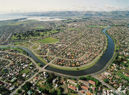
Have you ever been curious how the urban area you call home is planned and developed for? Why are things built where they are? Where do the resources come from?
Since completing a nationwide 1:250,000-scale geological map(external link) a decade ago GNS Science have been developing geological maps for urban areas across the country. Providing information on rock and sediment types, their physical properties such as strength and fracturing, and the nature of landforms developed on them, are all key aspects to urban geological mapping.
The Urban Geological Mapping Project, funded by the New Zealand Government, requires a broad diversity of geoscience skills.
At the heart of this work is GNS’s Urban Geological Mapping Project team. The team works closely with various GNS colleagues in other teams. The project touches on many aspects of our Science Themes and is linked to other research programmes and projects across the organisation and has partnerships with various stakeholders including universities, territorial and regional authorities, and consultancy practitioners.
What does a GNS Urban Geological Map show?
Urban Geological Maps provide lots of detail and information. Using Geographic Information System (GIS) office-based (desktop) compilation of geoscience information from various sources, a geological map shows the distribution of geological materials and geological structures across urban and developing areas. Fieldwork is commonly used to check and improve desktop interpretations. Companion geomorphology maps show the extent of landforms such as river terraces, coastal plains, human-made (anthropogenic) ground features and hill terrain. The use of LiDAR base maps allows for accurate positioning of geological and landform boundaries.
By offering up-to-date information on the geology beneath New Zealand’s towns and cities, these maps enable better-informed approaches to planning, development, and urban management by local government authorities. Geological map information provides a broad-based scientific foundation for decisions around the utilisation and management of resources like aggregate and groundwater, or the reduction of risk in areas affected by geological hazards. The maps can also provide improved insights into the geological foundations of properties, buildings, and infrastructure.
Urban Geological Maps provide information that can help people plan more wisely for the future.

As urban areas continue to expand and grow, the use of urban geological mapping is vital to ensure that councils and decision-makers have up-to-date information to help with planning of developments and management of geological resources for the future
GNS's urban geological mapping offers a distinctive contribution to the geoscience community: GNS's niche is to provide broader geological perspectives and develop geological frameworks that give others context for more detailed research or investigation.
Early in our mapping work in the Auckland area, it was quickly realised that the existing stratigraphic framework (rock type subdivision) for the Auckland area didn’t provide sufficient detail for many in the geotechnical community. To help resolve this, workshops were held in 2020 with many key stakeholders and end-users within the Auckland geoscience community such as Auckland Council, geotechnical consultancies, Auckland University, and other geological practitioners. Through collaboration, a different way of categorising the stratigraphy was produced, and this revised stratigraphic framework is now being used by several geotechnical consultancies, helping them to classify and understand the rock and sediment types they may encounter at a project site, and then understand how the geological material may behave during construction.
Case Study: Pukekohe map products
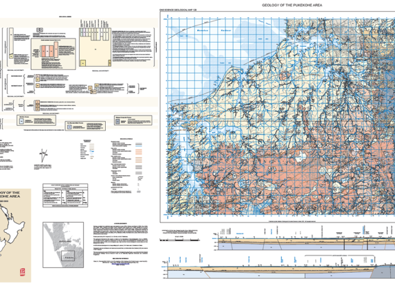
A great example of GNS's Urban Geological Mapping products in use are the recently developed geological map and 3-dimensional geological model of the Pukekohe area. This map is the first detailed geological map of this area in nearly 30 years, and while compiling it GNS experts identified and more accurately located landform features of the area such as landslides, fault lines, and extinct volcanoes. A better understanding of faults in Waiuku, Pukekohe, Pokeno and Drury – not only their locations but also their activity – allowed them to be incorporated into the New Zealand Community Fault Model, and subsequently the most recent revision of the New Zealand National Seismic Hazard Model. The Pukekohe maps will significantly contribute to the understanding of New Zealand’s geology and geohazard risks, and the data will be a valuable and up-to-date resource for geologists, planners, and geotechnical practitioners, as well as the Auckland and Waikato District councils.
Printed and printable geological maps can be obtained via the GNS Science Online Shop. (external link)