New research assesses damage from volcanic ashfall
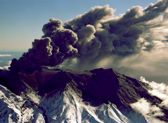
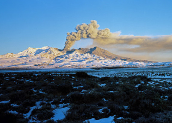
Hundreds of thousands of North Island homes could be covered in ashfall following a volcanic eruption, and assessing the damage could take months.
New research funded by the Natural Hazards Commission will enable authorities to quickly assess the damage from volcanic ashfall during and after an eruption to better respond to the needs of each community.
“A volcanic eruption could affect thousands of buildings around the North Island, and we need a New Zealand model that provides us with a quick assessment of the scale of the damage,” says Dr Josh Hayes, Natural Hazard and Risk scientist who led this research.
The research project aims to fill a gap between the existing internationally developed models and local New Zealand post-eruption data collection.
“We have not had any major ashfall since Mt Ruapehu erupted in 1995 and 1996, and that didn’t cause that much damage, so our understanding of the effects is highly informed by overseas experiences,” says Dr Hayes.
Dr Hayes explains that physically assessing ashfall damage is time-consuming, particularly widespread ashfall events, so creating a damage forecasting model is hugely beneficial for authorities and communities to concentrate resources.
“We will use existing overseas damage forecasting models, but will calibrate those models with specific New Zealand data rapidly following an eruption” says Hayes.
He says a rapid modelling tool that can be constantly adjusted with fresh data will be particularly critical if a volcano enters a prolonged eruptive episode with ongoing ashfall events.
NHC Head of Research Dr Natalie Balfour says the GNS project is a great extension of the continuous investment NHC makes into volcanic hazard research.
“Over the past years, NHC has funded projects that have provided valuable insights into how New Zealand homes stand up to different amounts of ash on their roof, as well as predicting where the ash will travel by using MetService weather forecasting,” says Dr Balfour.
Dr Hayes says his project builds on the findings from previous NHC-funded research.
Knowing where the ash will travel and forecasting the amount of ashfall loading that accumulates on roofs in different areas will be the key metric when we assess the damage to buildings from volcanic ash.
The new model will use scientific data, engineering reports and satellite images, but also crowd-sourced data, like social media, to build a comprehensive picture after an eruption.
“Naturally the reliability of information varies across different sources, so our methodology will factor in the reliability of different post-event data,” says Dr Hayes who adds that this innovative approach will optimise the use of limited data post-event to ensure the most accurate damage assessment.
The collaborative team, consisting of GNS, University of Canterbury, and Nanyang Technological University (Singapore), is currently creating scenarios and developing the modelling approach, and the two-year project is expected to complete the new modelling tool by the end of 2025.
This story was first published by the Natural Hazard Commission Toka Tū Ake on 23 September.(external link)