New Zealand Community Fault Model released

New Zealand’s national earthquake science toolkit is now even better equipped with recent release of the GNS Science New Zealand Community Fault Model (NZ CFM)
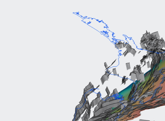
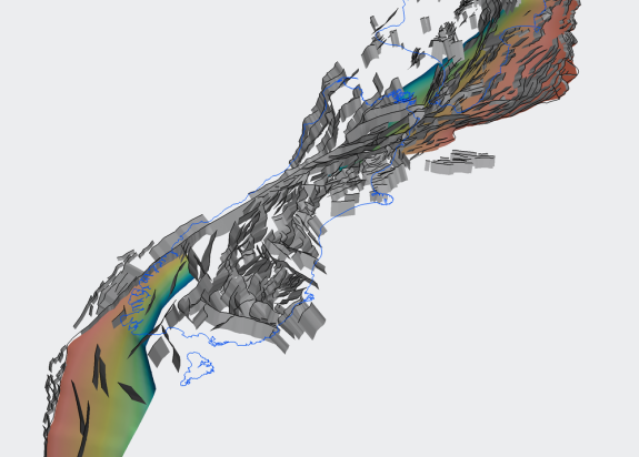
The new model offers both 2D and 3D representations of active, or potentially active, faults that are considered capable of producing damaging earthquakes throughout New Zealand and neighbouring offshore regions.
The collective knowledge of the earth science community has come together over the past two years to help develop the model, with contributions from more than 40 geologists and geophysicists, engineers and policy makers. The result of this scientific collaboration is an agreed representation of faults that can be used to improve seismic hazard assessment.
Earthquake science and seismic hazard assessment requires detailed knowledge on the location, geometry and motion of active faults. From that information, scientists can determine ancient and historic fault rupture histories and estimate how future earthquakes might behave.

Until now, a freely accessible three-dimensional model of active faults representing New Zealand’s collective science knowledge has not been available
“One of the most exciting aspects of the NZ CFM is that it is available online, free of charge and is accessible for anyone.”
The NZ CFM builds on previous two-dimensional fault models, updating the information we already had by applying the improved knowledge and understanding of fault and earthquake activity collected over the last decade. The new fault model will be used and adapted for a range of scientific and practical uses.
“The NZ CFM will be used by the scientific, engineering and insurance industries to better understand earthquake hazard and risk to our communities,” Van Dissen said.
“Its most immediate function is to serve as a foundational component for the revision of the New Zealand’s National Seismic Hazard Model, due for release later this year.”


The development of the NZ CFM was funded by the Ministry of Business, Innovation and Employment (MBIE) and the Earthquake Commission (EQC) through the National Seismic Hazard Model and the National Science Challenges Fund, along with contributions from GNS Strategic Science Investment and Capability Development funds.
In releasing the NZ CFM we acknowledge the collective work of our science community and in particular wish to thank Russ Van Dissen, Nicola Litchfield and Hannu Seebeck, and the many other individuals that have worked alongside them to get us to this point. We also recognise and celebrate the collaborative effort from GNS Science, NIWA, University of Canterbury, TerraGeoLogica, Victoria University of Wellington, Golder Associates, University of Otago, University of Waikato, Beca Group, University of Auckland, and Geoscience Australia.
