Scientists reaffirm earlier findings on the fate of Pink and White Terraces

Researchers at GNS Science have reconfirmed work they undertook five years ago on the fate of the world famous Pink and White Terraces after the 1886 eruption of Mount Tarawera.
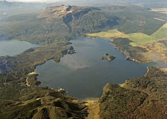
In a peer-reviewed paper in the Journal of The Royal Society of New Zealand published online this week, they stand by their earlier findings that the White Terraces were largely destroyed in the eruption and confirmed that remnants the Pink Terraces may lie at the bottom of Lake Rotomahana.
The paper is partly in response to recent research based on historic maps claiming that the Terraces are buried partly on land at the edge of modern Lake Rotomahana.
Lead author of the GNS Science paper, Cornel de Ronde, said an exhaustive examination of his team’s work at Lake Rotomahana between 2011 and 2014 had shown that the present-day location of the Terraces could not be buried on land, or at the edge of the Lake.

We’ve re-examined all of our findings from several years ago and have concluded that it is untenable that the Terraces could be buried on land next to Lake Rotomahana.
Findings in the just-published paper are consistent with historic photographs taken by Charles Spencer in 1881 and published maps by pioneer geologist and explorer Ferdinand von Hochstetter, who made detailed surveys and maps of the region in the 1860s.
Between 2011 and 2014, GNS Science in partnership with colleagues from Woods Hole Oceanographic Institution in the US and the University of Waikato conducted a number of investigations at Lake Rotomahana.
They collected an unprecedented amount of information to get a better understanding of the complex series of events that transformed what was an on-land geothermal system to one that was drowned after debris from the eruption of Mount Tarawera blocked the normal outflow of the lake to nearby Lake Tarawera.
Techniques they used included high resolution bathymetry, magnetics, measurements of the water column, side-scan sonar, seismic surveys, underwater photography, and surveys of gas plumes and of the amount of heat entering the lake from geothermal systems under the lakefloor.
The combined power of these techniques enabled them to piece together a definitive narrative about what happened on the day of the eruption and in the weeks and months that followed.
Their research was published in 2016 as 12 peer-reviewed papers in a special issue of the high-profile Journal of Volcanology and Geothermal Research.
Their investigations were driven partly out of scientific curiosity and partly by the desire to clear up long-lasting uncertainties about the eruption and its impact on the lake and the Pink and White Terraces.
With its international connections, project leader GNS Science was able to bring the latest technology and scientific heft to provide the kind of information and detail that had not been possible with previous investigations of the lake and surrounding areas.
The destruction of the majority of the Terraces is perhaps not surprising given that the 1886 eruption was so violent it was heard in Auckland and in the South Island. The blast left a 17km-long gash through Mount Tarawera and southwestwards beneath lake.
After the eruption the level of the Lake rose by at least 60m and its area increased by about five times, drowning all the original landmarks.
Dr de Ronde said that the recent suggestion that there should be an archaeological site investigation at the edge of the Lake, including the use of ground-penetrating radar, to pinpoint the location of the Terraces would be “fruitless” as the remnants of the Terraces were sitting at the bottom of the Lake.
Dr de Ronde said GNS Science could not have undertaken the investigation of Lake Rotomahana without the assistance of Woods Hole Oceanographic Institution in the United States, the University of Waikato, the Te Arawa Lakes Trust Board, tourism operator Waimangu Volcanic Valley, and the Bay of Plenty Regional Council.
