World-first project to map the emissions of every town and city in Aotearoa
GNS Science Te Pū Ao is leading research to map urban carbon dioxide sources and sinks, providing vital information to help New Zealand meet our net-zero 2050 target. We’ll be the first nation in the world to have these insights for every urban centre.
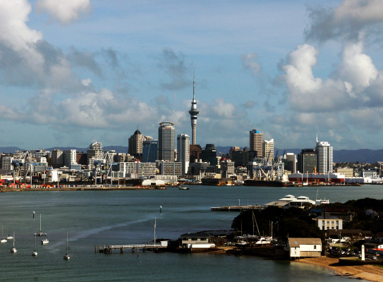
With carbon dioxide (CO2) from fossil fuel burning in urban areas responsible for 40% of Aotearoa’s gross carbon emissions, understanding just how much CO2 is released by our cities and how much is absorbed by urban green spaces is key for effective mitigation policies. We know that urban development and the form of our cities can influence both emissions and absorption of CO2, but there is insufficient data available to assess how urban vegetation and land management choices impact our net emissions.
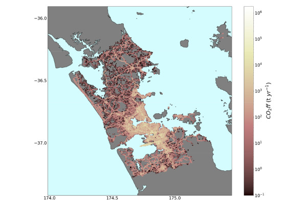
A new research programme Reducing Aotearoa’s urban carbon emissions – a critical pathway to net-zero 2050, led by GNS Science Te Pū Ao and supported by the Ministry of Business, Innovation and Employment’s (MBIE) Endeavour Fund, is seeking to change this by developing high-resolution emissions information for every town and city in Aotearoa New Zealand. The project will map urban CO2 sources and sinks in space (down to areas of approximately 500 m), time (hourly), and by sector (e.g. transportation, residential, industrial and urban vegetation). The maps will be developed using a combination of cutting-edge atmospheric observations and modelling tools.
Dr Jocelyn Turnbull, the project lead and GNS Science Radiocarbon Science Leader, says having this comprehensive and granular emissions information will be critical to achieving our mitigation targets.
With this detailed, validated emissions information in hand, Aotearoa can make informed urban planning and development decisions to mitigate emissions now, and in the future.
Exploring how urban development choices, land cover and socio-economic factors influence emissions
The research will compare the changes in emissions with landcover, building, and street maps, to understand the impacts of recent greenfield developments and urban intensification. Analysis of socioeconomic metrics mapped across the cities will provide insights into how factors such as population density and socioeconomic status influence emissions.
With traffic being a major emission source in cities, understanding how new developments change traffic emissions is one of the research goals.
“Traffic emissions vary with time of day, and day of the week, but we also know that how we build our cities can make a big difference to traffic emissions.”
Understanding the role of the urban landscape in absorbing CO2 is equally important.
“It’s well known globally that urban trees and green spaces play an important role in managing temperature and cleaning the air, but the role of urban landscapes in offsetting emissions is very poorly known internationally, and not at all for sub-tropical cities like Auckland,” says Turnbull.
"There's so much that we don't yet know about how urban development decisions and land use impact our carbon emissions."
Jocelyn Turnbull
Radiocarbon Science Leader / Lead Scientist - Rafter Radiocarbon Laboratory
View bioDevelopment choices will influence traffic emissions, and importantly, but less obviously, development also changes how much carbon is taken up by urban trees and parklands.
‘Bottom-up’ modelling verified by ‘top-down’ atmospheric measurements
The programme takes a dual-approach – building ‘bottom-up’ maps of emissions and using atmospheric observations to verify and improve the models.
Bottom-up modelling draws upon economic data such as fuel imported to New Zealand, vehicle counts and other transport data, commercial and residential building information, flight arrivals and departures, industrial and manufacturing information, using it to creates maps of emissions over space and time.
The researchers have also employed a new landscape (urban biosphere) flux model that uses satellite measurements of ‘greenness’ and estimates the behaviour of different types of vegetation.
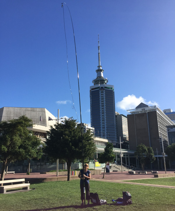
Atmospheric measurements of the actual distribution of CO2 across the urban centres, taking into account wind and other weather factors, will be used to verify and refine the models. The researchers will use radiocarbon (14C) to separate fossil fuel CO2 from that coming from the natural process of photosynthesis (where vegetation absorbs CO2 ) and respiration (where the biosphere releases CO2).
Other gas tracers (carbon monoxide, black carbon and 222Radon) will allow the team to further separate the different CO2 sources, such as the amount coming from wood burning, vehicles, and household gas appliances, and to quantify the CO2 emission rate.
The programme will use a new technique to measure the rate of photosynthetic CO2 uptake, made possible by innovations in instrumentation.
The work builds upon the approach taken with a previous research programme, CarbonWatchNZ, which resulted in a detailed picture of Auckland’s carbon balance.
“While our initial results suggest that the landscape is offsetting some of our emissions, we have a lot of new science to do to understand what is driving that,” says Turnbull.
“We’re adding new measurements in Auckland, Christchurch and other centres around the country that will help us determine the balance of carbon uptake by photosynthesis and carbon release by respiration.”
Science to support the transition to low emissions economy
The programme will work with councils, central government, industry and iwi to ensure that the data produced is useable and to help them to better understand emissions to inform mitigation policy and ultimately to reduce emissions.
The project has been co-designed with urban iwi Ngāti Whātua Ōrākei, Ngāi Tahu, Ngāti Te Ata. The data will be used to support kaitiakitanga through urban environmental restoration and management as they develop their land.
This project will enable Aotearoa to be the first country in the world with real-world emissions data for every urban centre, to guide future development across Aotearoa’s varied urban environments.
The project is led by GNS Science Te Pū Ao, with research partners NIWA, Manaaki Whenua Landcare Research, University of Auckland, DotLovesData, Ministry for the Environment, StatsNZ and Ngāti Whātua Ōrākei. The team are also working with international collaborators from Australia, USA and Switzerland, and a stakeholder advisory group from central government, local government, iwi and industry.
-
Net-zero 2050
To limit global warming to 1.5°C, as called for in the Paris Agreement, emissions need to reach net zero by 2050. This means cutting greenhouse gas emissions to as close to zero as possible, with any remaining emissions re-absorbed through sinks such as plants or by the ocean.
Aotearoa New Zealand has set in law a net-zero target for greenhouse gas emissions (other than biogenic methane) as part of The Climate Change Response (Zero Carbon) Amendment Act 2019.
Under the Paris Agreement we are also committed to an ambitious 2030 emissions reduction target – to reduce net greenhouse gas emissions to 50% below 2005 gross levels. Costly international mitigation options (purchased offsets) are a key part of New Zealand’s strategy to reach this challenging goal. This research programme will create new knowledge about emissions and sinks, allowing enhanced mitigation of our domestic emissions.
-
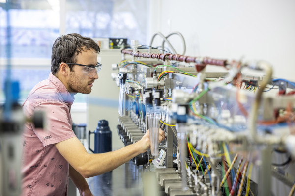
Rafter Radiocarbon Laboratory
GNS Science’s Rafter Radiocarbon Laboratory is crucial to this work, providing high precision measurements of radiocarbon in CO2. It’s the oldest continuously operating radiocarbon facility in the world, with a long history in climate science – it was the first lab in the world to measure radiocarbon in atmospheric CO2 in 1954.
It’s the only laboratory in New Zealand that can do these high precision measurements, and there are only a few others worldwide that can do so, so it has a vital role to play in understanding our carbon balance.