Young river landslide biggest in 16 years
Geologists have found that the Young River landslide in Mt Aspiring National Park is the biggest landslide in New Zealand since the top fell off Mount Cook in 1991.
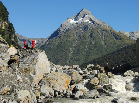
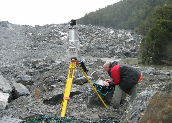
Using a tripod-mounted laser scanner, geologist Chris Massey and surveyor Neville Palmer, both of GNS Science, have measured the volume of the landslide at 13 million cubic meters.
The Mount Cook rock avalanche of 14 December 1991 resulted in 16 million cubic meters of debris being deposited on the Tasman Glacier.
The Young River landslide occurred on August 29 and was discovered by a helicopter pilot three weeks later. Seismic waves generated by the landslide were the equivalent of a magnitude 2.9 earthquake, and were recorded by seismic instruments in the central South Island.
In recent weeks geologists from GNS Science have installed a range of equipment at the dam site to gather information about the landslide and the level of the lake.
The landslide impounded a lake measuring about 2km long and 500m wide. It is about 60m deep and contains about 26 million cubic metres of water. The rising lake overtopped the debris dam on October 5 and water is draining away through a natural channel.
Mr Massey said large rock avalanches and landslides ranked with volcanic eruptions and earthquakes as major earth forces that have been shaping New Zealand's landscape for millions of years.

While big landslides are not weekly events, they are a natural landforming process that occur worldwide. When you combine steep terrain made up of weak schist with high rainfall and earthquakes, it's a sure recipe for landslides
The portable laser scanner used by GNS Science is designed for rapidly gathering hi-resolution three-dimensional topographic data and images at kilometre scales.
Surveying from three locations at the dam, Mr Massey and Mr Palmer collected two million measurements which they used to generate a three-dimensional computer model of the landslide deposit.
"This information has greatly improved our knowledge of the Young River landslide, and provides essential information in assessing its stability as a dam."