Hokianga Harbour sedimentationTātaihia te Parataiao o Te Wahapū

189035 Kyle Bland GNS Science

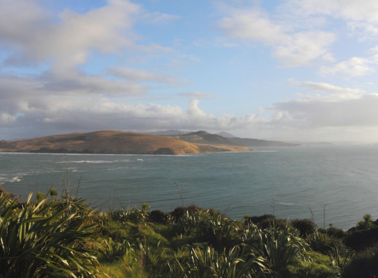
GNS Science is working with Te Rarawa iwi in Te Tai Tokerau/Northland to help them manage and restore parts of Hokianga-Nui-a-Kupe (Hokianga Harbour).

Overview

Communities around Hokianga-Nui-a-Kupe in Te Hiku – the very far north of New Zealand – want to restore and regenerate their harbour’s mauri (life force). Human activity has resulted in species loss, poor water quality and a build-up of sediment in the harbour. GNS Science and Te Rarawa worked together to find out how this might be done.

The main funding and impetus came from the MBIE Vision Mātauranga Capability Fund, with co-funding support from GNS’s Global Change Through Time and Zealandia Strategic Science Investment Fund programmes.

This project aimed to

  • identify possible causes for the deterioration in the mauri of Hokianga-Nui-a-Kupe
  • enable the partners to develop management approaches informed by both science and Te Rarawa mātauranga

To achieve these objectives, we

  • took core sediment samples from different locations across Hokianga Harbour, guided by iwi
  • included Te Rarawa representatives in the core collection mahi, and analysis work in Wellington

The Project

Drilling back 1,000 years

Research began in March 2020 with a hui at Ngai Tūpoto Marae, Motukaraka.  Local identities, with extensive knowledge of the history of changes in and around the Hokianga area in the past century, shared their mātauranga with the project team.  These insights underpinned the subsequent sample collection mahi, which used a hand-held percussion coring system to extract more than 15 sedimentary cores, each up to 1.8 m long. They were collected from seven separate sites along a c. 15 km-length of the lower and middle reaches of Hokianga-Nui-a-Kupe, between Rangi Point and the Waima River mouth near Rawene.

Cores were taken from Rangi Point (Waitapu), Punehu, Te Karaka (Whakarapa River mouth), Te Tapuwae River mouth, Ngai Tūpoto Marae, Motukaraka (Wairupe Creek), and the Waima River mouth.

Working with Te Rarawa

This project was a partnership designed to enhance connections between Te Rarawa iwi and GNS Science through the sedimentation study.

It used scientific methods to help understand the causes of environmental changes in the mauri, enabling Te Rarawa to develop management approaches informed by both science and their mātauranga.

In March 2021, seven Te Rarawa participants travelled to GNS Science to participate in hands-on sampling and analysis of material from the cores. This contributed significantly to the two-way sharing of knowledge and skills that underpinned and guided this project.

The project team and other partners delivered marae-based environmental education kaupapa to the next generation of kaitiaki across Te Hiku.  These included Geo Noho and Noho Taiao.  In these multi-day projects, amongst other hands-on activities, school children went into the field to collect and analyse their own sediment cores.

Where to from here?

GNS Science has invested heavily to expand our coastal research activities and capability. Activities and results from this project are included in our multi-year Integrated Coastal Dynamics research project, which is part of our Global Change Through Time programme.

Growing our capacity and work in the Hokianga and Te Hiku areas is a cornerstone of this investment and new direction.

The results will also be used to underpin a Te Rarawa / GNS Science co-design of a MBIE Endeavour Research Programme bid with Mātauranga Māori as its cornerstone.

The two organisations will also pursue further Te Ao Māori-centric education projects for Te Hiku taitamariki.

Bland Kyle 2244

Kyle Bland Senior Geologist

I’m interested in the geological, paleogeographic, paleoenvironmental, and biogeographic evolution of the New Zealand region at multiple scales and time frames. I have extensive field experience examining sedimentary rocks across much of Aotearoa, with particular expertise in the eastern North Island and Taranaki-Whanganui regions. I am a current co-compiler of new geological and geomorphological maps within the Auckland region, and lead GNS’s multi-disciplinary ‘Coastal Change and Adaptation’ research project. My passion for community outreach means I am a frequent proponent, participant, and leader of activities particularly targeting school children and their teachers, and iwi — especially in the Northland, eastern North Island, and Taranaki regions, including via the award-winning “GeoCamp” initiative.

View Bio Contact Me
Research project details

Collaborators: Te Rarawa Anga Mua

Duration

2019–2021

Funding platform

Ministry of Business, Innovation and Employment’s Vision Mātauranga Capability Fund – Te Pūnaha Hihiko

Status

Completed

Leader

Kyle Bland, GNS Science

Find more content related to:

GNS Science topics
Tags

By continuing with this download you agree to abide by the rules laid out in the Terms and conditions/Terms of use listed on this page.

If there are no specific Terms and conditions/Terms of use listed then please refer to our Copyright and Disclaimer page and Privacy Policy page

Download