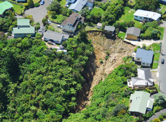
New guidance encourages planners not to let landslide risk reduction opportunities slip by

Today GNS Science has released new land-use planning guidance to manage and reduce the risks of landslides.
The Landslide Planning Guidance: Reducing Landslide Risk through Land-Use Planning strongly encourages landslide risk to be considered early in the land-use planning decision-making process to avoid costly and potentially dangerous new developments that could pose a risk to people, property and the environment.
Guidance co-author and GNS Engineering Geologist Dr Saskia de Vilder said on average landslides cost Aotearoa New Zealand $250 million each year and have resulted in more fatalities than earthquakes, volcanoes and tsunami combined.
“Last year saw several significant weather events including Cyclone Hale, the Auckland Anniversary Weekend storm, and Cyclone Gabrielle,” Dr de Vilder said.
“As we’ve seen, these events can cause flooding and considerable landslide damage, resulting in loss of life, damaged and destroyed homes, and disrupting and isolating communities long after the rain has stopped."
Estimates for landslide damage from Cyclone Gabrielle alone are close to $1.5 billion. This highlights the importance of considering not just the likelihood, but the consequence of landslide hazards from large storm events.
The Guidance has been developed to support a risk-based approach to land-use planning that considers changing weather patterns as well as current risk assessment, management and mitigation practices.
At a minimum, the Guidance recommends councils develop a landslide susceptibility map to better inform important decisions that determine where and how we live.
“Human activities such as the construction of buildings, earthworks, changes to surface or subsurface drainage and vegetation removal may increase the risk of landslides. The Guidance aims to ensure the risk from these types of activities are known and considered in district plans and resource consent applications rather than much further down the track,” Dr de Vilder said.
Guidance co-author and GNS Senior Natural Hazards Planner Scott Kelly identifies that land-use planning needs to consider the most up to date, fit-for-purpose information to inform decision-making.
"This Guidance provides the blueprint for what information is needed to undertake landslide analysis and assessment to support different land use decision-making," Scott Kelly said.
It’s not about preventing development; it’s about having the right information to inform the right development in the right place.
“It is hoped the recent storm events and this Guidance will be a catalyst in changing land-use planning and practice, so that the future impacts of landslides will be reduced," Scott Kelly said.
The Landslide Planning Guidance updates previous guidance released more than 15 years ago and emphasises the need to consider climate-change scenarios that are likely to exacerbate landslide hazards due to changing weather patterns.
Visit the Guidance web page for more information and to download a copy of the Guidance.
Collaborators and funding
The Guidance has been developed by the MBIE-funded Earthquake-Induced Landscape Dynamics programme and as part of the Hazard and Risk Management Strategic Science Investment Fund programme.
The development of the Guidance has been overseen by a Steering Committee made up of members from Toka Tū Ake EQC, Nelson City Council, Ministry for the Environment, NZ Geotechnical Society, Environment Canterbury, Queenstown Lakes District Council and GNS Science.
The guidance has been endorsed by Toka Tū Ake EQC and the Ministry of Business, Innovation and Employment (MBIE).