Te Whakaheke o Te Wai – understanding New Zealand’s groundwater

Our Science

01 December 2021

Te Whakaheke o Te Wai

Te Whakaheke o Te Wai is a world-leading research programme that is building a better understanding Aotearoa New Zealand's largest freshwater resource.

The name loosely translates to "meandering waters" and reflects the complex and ambiguous nature of groundwater systems. As aquifers and river catchments are hidden underground, we have a limited understanding of how the water flows, and how long that takes.

Not having the full picture of New Zealand’s groundwater is the main reason that groundwater resources are not being managed sustainably

Dr Catherine Moore Team Leader of Groundwater Modelling GNS Science

“Te Whakaheke o Te Wai will give us the knowledge we need to build a more comprehensive picture of groundwater – one that will support better management of this precious taonga”.

The GNS-led research team is collecting complementary hydrogeological, chemical and isotope data to trace the origins, age and flow pathways of groundwater across the country. Combined with mōhiotanga Māori (Māori understanding), this data is already providing insights into the effects of geology and different seasons on groundwater systems.

Te Whakaheke o Te Wai transcript
The name of this research program  is Te Whakaheke o Te Wai or  
loosely translated the meandering  waters, and that is a reflection of  
our groundwater systems and also our focus that  we're working in Hawke's Bay on, on the Hirotanga  
catchment, and the nature of the water and how it  flows through our lands. The aim of the project  
is to better understand groundwater flow, the  the pathways of groundwater flow and the origins  
of of groundwater beneath the surface with  the idea that if we can understand it better  
we can manage it better the project. Is a  sort of sum of three parts isotope science  
mataranga knowledge and modelling and I lead  the modeling stream. And what we're doing is to  
build a framework that allows models to be built  very very quickly as soon as there's a concern  
and you tailor the model to answer the question  or the concern that it's meant to be addressing,  
and they'll answer the question a lot more  accurately. So my role in this project is to  
ensure that mataranga maori or maori knowledge  is incorporated into this project it's important  
that we increasingly and incorporate indigenous  knowledge with western science when we're trying  
to and better understand things particularly in  this case around the water and and how how we can  
better look after this resource that we have. For  Hawke's Bay and one outcome from this project is  
that we are definitely going to be able to manage  our water resources much more effectively, but as  
a nation I think having these tools that can be  applied nationally will help address the some  
of the big problems we have with water resource  management that are fairly consistent across the  
country. Over many years I have been developing  techniques to read the isotopic signature of  
groundwater which can tell us about what where the  water is being recharged so the recharge source,  
but also how long it has been underground which  then will give us a better understanding of how to  
manage groundwater resources. Apart from just the  the tools that this project's going to provide,  
I think it's one of the best things about it is  working with a really really super talented bunch  
of people at GNS science, and and getting into  some novel research and practical science that  
is pushing the limits of what's being done before  so in that respect it's really quite exciting.

Te Whakaheke o Te Wai

Hear from the project team in our new video

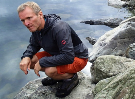
4341 Lloyd Homer GNS Science
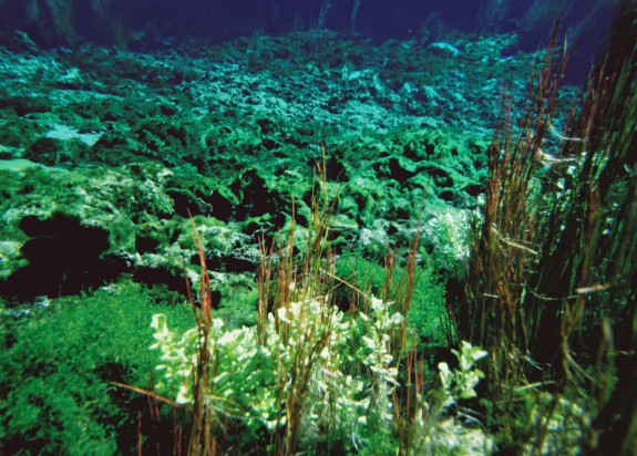
Underwater view of Te Waikoropupu Springs (Pupu Springs), Takaka. Credit: GNS Science.

A key part of this programme is evolving groundwater modelling capabilities that will better integrate isotope tracers, mātauranga (knowledge), and other data across a range of scales. These new meta-models allow for multiple sources of information and data to be run in parallel, reducing the inherent uncertainty of basic models.

Using this meta-model approach, the team are mapping Aotearoa New Zealand’s 200 known aquifers and abundant river catchments. This will be the world’s first nationally continuous maps of groundwater age, origin and flow paths.

They have already completed detailed mapping of groundwater on the Heretaunga Plains, including an aquifer critical to the Hawke’s Bay community.

129779 Dougal Townsend GNS Science
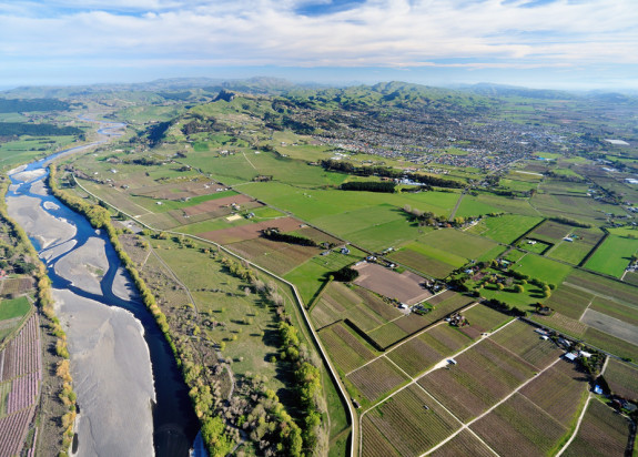
Tukituki River flowing through Heretaunga Plains. Credit: Dougal Townsend, GNS Science.

“[The programme] is getting into some novel research and practical science that is pushing the limits of what’s been done before, it’s really quite exciting” says Jeff Smith, Science Manager at Hawke’s Bay Regional Council”.

Deeper knowledge of Aotearoa’s groundwater will boost freshwater quality and security of supply – which will benefit drinking water safety, cultural values and sustainability for agriculture, tourism, and regional economies.

The team are working hard to keep communities informed about the health and protection of their water. The research outputs of the programme will be made publicly available, and the team are developing a website and series of outreach videos.

Morgenstern Uwe 1862

Uwe Morgenstern Lead Scientist - Tritium Laboratory

Present research/professional speciality: Since 1998, Dr Morgenstern has led the Isotope Hydrology team and managed the Water Dating Laboratory at GNS Science. His scientific expertise centres on the use of isotopic methods, such as tritium and 32Si, for determination of the age of water, ice, and sediments. A recent international assessment conducted by the IAEA has shown that, under Dr. Morgensterns management, the GNS Science Water Dating Lab has become the worlds most accurate tritium analytical facility (by a large margin). The information derived from the age measurements is crucial for reconstruction of past global climate and for management of groundwater and surface water resources. Research leadership: New Zealand Ice Core Programme GNS Science Hydrogeology Core Programme

View Bio Contact Me

Find more content related to:

GNS Science areas

By continuing with this download you agree to abide by the rules laid out in the Terms and conditions/Terms of use listed on this page.

If there are no specific Terms and conditions/Terms of use listed then please refer to our Copyright and Disclaimer page and Privacy Policy page

Download