
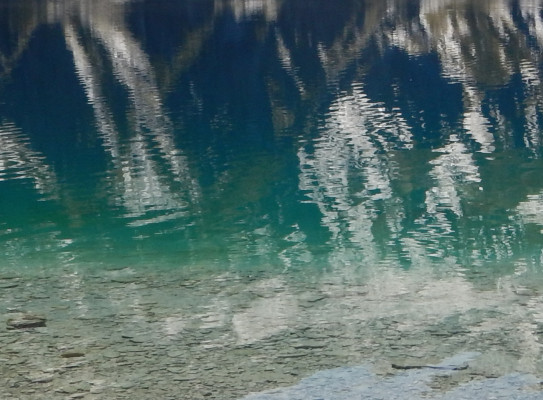
Lake OhauUnlocking New Zealand’s stormy past
The Lake Ohau Climate History (LOCH) project was designed to retrieve a sedimentary archive going back 17,000 years. Core samples have provided a record of glaciers, wind, rain, floods and plants that will help understand our climate history.
Overview
Drilling began at two sites on the lake in February 2016. At 6am on 3 March, the drilling crew literally hit rock bottom, recovering Ice Age gravels from 80 metres below the lake floor. They had a full geological record from the Ice Age to 2016.
LOCH was an international collaboration between three research institutes and five universities – GNS Science, Victoria University of Wellington, University of Otago, Northern Arizona University, Istituto Nazionale di Geofisica e Vulcanologia, University of New South Wales, Indiana State University and NIWA.
Data from LOCH is still being analysed.
The project
Windy Ohau is a geological treasure trove
Ohau appears frequently in Māori place names and is usually translated as the “windy place”. What does wind have to do with climate change?
New Zealand is affected by three winds – the Southern Hemisphere westerly winds, the influence of El Niño–Southern Oscillation and the Interdecadal Pacific Oscillation. They have a considerable influence our rainfall. In the South Island, that’s meant less and less rain each summer since about 1973.
But wind alone wasn’t enough to give the full climate history. The project needed high-fidelity climate archives that span millennia, including intervals of past warmth. This would provide some perspective on current climate change and enable a more robust assessment of climate dynamics around the southern mid-latitudes.
How the team got the critical data
The team chose an area where sediment layers were relatively undisturbed since they were deposited. They used a combination of drilling, bathymetric surveys and seismic profiling of the lake-bed to re-create history.
The sediment preserved beneath Lake Ohau offered an unprecedented opportunity to reconstruct South Island hydrology at annual timescales over the Holocene and at high resolution since the Last Glacial Maximum. This record is of major global significance as similar high-resolution paleoclimate data series are exceptionally rare at the Southern Hemisphere mid-latitudes.
The team found seasonal signatures in the cores, show what was happening at different times of the year, as dictated by the lake’s temperature – warmer in summer, colder in winter.
Between 2011 and 2015, the team also collected high-resolution seismic reflection data giving us an “acoustic basement” – the 150m-thick layers of sediment dating from the post-glacial period.
The innovative response to the drilling challenge
LOCH presented drilling challenges unlike any other in New Zealand. The drill system had to work in at least 100m of water and recover near-continuous high-quality core through an 80m thick sequence of soft sediment (sand and mud).
Then there was Ohau’s famous wind and wave conditions which can be extreme. The team had to design a drilling system that could mobilised quickly, moved to shelter in high winds and rough water, and then relocate above the hole once conditions improved.
In 2015, Marine Surveyors (Mtech Ltd), Webster Drilling and Exploration Ltd and engineers at Victoria University of Wellington designed the initial barge concept. Apart from the state-of-the-art, barge, the pontoon and drill could be dissembled and moved in a standard shipping container.
A 17,000 year calendar
CT scanning – then relatively new for geology – produced annual sedimentary layers present throughout the entire 17,000 year-long record.
What the scanning showed:
- fine-grained layers with pulses of gravel carried down the lake and dropped by small icebergs
- progressive warming which caused the glaciers to retreat from the lake, spelling the end of icebergs and gravel deposits
- increasingly complex layering from the weather signature
- evidence of large floods over time
- leaf fragments and twigs
- A picture of the landscape as it emerged from the last ice age. Grasses and shrubs gave way to native conifer trees around 10,000 years ago, then rapid expansion of beech forest from ~7000 years ago.
Where to from here?
In 2017, the team proposed to integrate paleoenvironmental reconstructions based on LOCH drill cores with similar records from Antarctic ice cores(external link) and sediment cores(external link) from sub-Antarctic islands and Patagonia.
Combining observations with global and regional climate model simulations will improve our understanding of the past causes, timing, and magnitudes of high-frequency climate variability in the Southern Hemisphere mid-latitudes. In turn, this will help us better anticipate potential future behaviour.
Research programme details
Collaborators: University of Tasmania, University of Otago, Istituto Nazionale di Geofisica e Vulcanologia, Italy, Northern Arizona University, USA, University of New South Wales, NIWA, Indiana State University, USA
Duration
Funding platform
Marsden Fund
Status
Completed
Programme leaders
Dr Richard Levy and Dr Marcus Vandergoes, GNS Science
Dr Gavin Dunbar, Antarctic Research Centre, Victoria University of Wellington