SkyTEM Aerial Aquifer Mapping
We rely on groundwater for drinking water, crop irrigation, and for sustaining the health and flow of our rivers and streams. SkyTEM helps us understand the extent of this hidden resource and how it interacts with surface water.
Overview
GNS Science is using state-of-the-art SkyTEM aerial electromagnetic technology to map aquifers across Aotearoa New Zealand, to provide vital information about where groundwater is stored, how and where it’s flowing, and its connection with rivers and wetlands above ground.
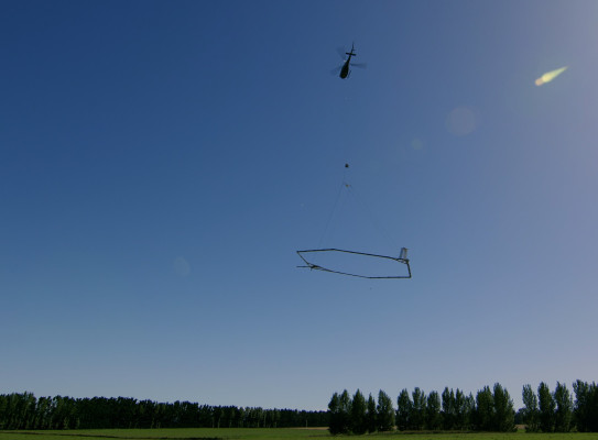
The surveys are carried out by a helicopter with a loop system suspended underneath. Transmitters in the loop send electromagnetic signals underground, and sensors measure the behaviour of the returning signals. The technology can ‘see’ what’s under the ground by analysing resistivity - the way the signals return - and creating a three-dimensional model of the aquifers. The electromagnetic signal is sensitive to rock type, porosity, permeability, clay content, moisture content, and properties of water such as salinity, all of which help in understanding aquifers and mapping and characterisation of aquifers.
Our cutting-edge groundwater numerical modelling team use the SkyTEM data to refine and reduce uncertainty in the numerical models used to make groundwater management decisions. This helps ensure sustainable management of this critical resource.
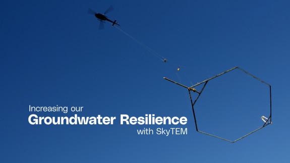
Increasing our groundwater resilience with SkyTEM
A cost-effective approach providing unprecedented detail
Traditional methods of gathering data from drilling boreholes and water-sampling are slow, costly, generally don’t go deep enough and only provide point-based information.
Because it is helicopter-borne, aerial electromagnetic mapping (AEM) can cover large areas quickly and cost-effectively, providing high-levels of detail about the properties of the subsurface. SkyTEM provides a three-dimensional view of the subsurface to around 300 to 600 metres depth.

Working with regional partners to support groundwater resilience
GNS Science has worked with partners such as regional councils in several regions across the country. We’ve collected data over more than 25,000 km of flight lines, in these areas:
Our work in Northland, Gisborne, Otago and Southland is delivered through Aqua Intel Aotearoa(external link), a partnership between Kānoa – Regional Economic Development and Investment Unit and GNS Science.
Aqua Intel Aotearoa works with scientists, the Government, councils, iwi and local stakeholders to improve our understanding of groundwater and surface water in the regions.
Each region has different geology that hosts their groundwater systems, and face different challenges. We work closely with our regional partners to understand their priorities, and produce models and tools that are fit-for-purpose for their decision making.
AEM provides councils with much greater resolution of data on which to model groundwater, test future scenarios and make allocation decisions. AEM markedly reduces the uncertainty in groundwater modelling, improving the confidence that councils can have in setting groundwater allocation. This leads to greater user certainty in water availability and investment security. It also improves surface water allocation policies, due to the strong connection between the groundwater and surface water.