

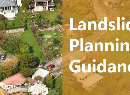
Landslide Planning Guidance: Reducing Landslide Risk through Land-Use Planning
Aotearoa New Zealand is a hilly country with high rainfall and frequent earthquakes. As such, landslides are an existing or potential hazard in many parts of the country, and climate-change is likely to exacerbate landslide hazards due to changing weather patterns. On average landslides cost Aotearoa New Zealand $250 million each year and have resulted in more fatalities than earthquakes, volcanoes and tsunami combined.
To support New Zealand to be safe, resilient and prosperous in a future of increasing landslide hazards, this Guidance sets out how land-use planning can use the right information on landslides to inform the right development in the right place.
Webinar
GNS co-authors Saskia de Vilder (Engineering Geologist) and Scott Kelly (Senior Natural Hazards Planner) walk through the guidance in this 40-minute webinar aimed at planners and geotechnicians.
An introduction to the GNS Landslides Planning Guidance – Watch an introduction to the GNS Landslides Planning Guidance transcript
Landslides cause about $250 to $300 million worth of damage a year in New Zealand and have caused more fatalities than any other natural hazards.
And recently Cyclone Gabrielle, the damage from that was about $1.5 billion from landslides. Across councils we saw a patchwork of approaches to landslide hazard and risk.
We didn't see many maps and we saw that other hazards like earthquake and flood had higher priority in councils and yet possibly didn't cause as much damage or death.
So the landslide planning guidance is a a document that provides a blueprint for planners in how you can reduce landslide risk using land use planning.
We brought together the two communities of engineering geology and planning.
We also put together a steering committee to provide advice throughout this process and that committee consisted of members from local and central government and other organisations.
Lastly we undertook targeted engagement and sort feedback from the engineering geology profession and the planning profession.
In a perfect world we wouldn't have any development impacted by landslides and what this guidance does is provides the framework to take the landslide information and interpret it in a way that land use planners can apply it to our policy development to how we zone land through to how we make decisions around resource consents.
Key message in the landslide planning guidance is that land use planners incorporate landslide analysis early in their processes.
We've divided the work that geotechnical and engineering geologists do into five different levels.
Once we've undertaken our Level A susceptibility analysis from there we can refine the areas that we want to undertake hazard and risk analysis based on that susceptibility analysis.
So we don't have to do those detailed assessments everywhere, only where they're needed.
It's about the right information informing the right development in the right place.
An introduction to the GNS Landslides Planning Guidance
An introduction to the GNS Landslides Planning Guidance
About the Guidance
The Landslide Planning Guidance: Reducing Landslide Risk through Land-Use Planning (the Guidance) updates the 2007 Guidelines for assessing planning policy and consent requirements for landslide prone land.
The Guidance is provided primarily for planning, policy and building compliance staff, but may also be of use to consultants, developers and professionals who provide landslide susceptibility, hazard and risk analyses.
The Guidance strongly emphasises the need to consider landslide risk early in the land-use planning decision-making process, particularly in district plans and for resource consent applications.
The Guidance sets out how landslide risk can be reduced through consistent land-use planning practices and approaches. Depending on the land use decision-making process, five levels of susceptibility, hazard and risk assessment are recommended from basic qualitative to detailed quantitative risk analysis. The Guidance also walks users through the multiple planning tools available to manage, mitigate and avoid landslide risks to prevent costly and potentially dangerous new developments that could pose a risk to people, property and the environment.
What the Guidance covers
This guidance comprises the following sections:
Section 1: Sets out Aotearoa New Zealand’s landslide hazard and past consequences and the outline of this guidance.
Section 2: Summarises the legislative context for managing landslide risk.
Section 3: Describes landslides, including classifications, processes and causes of landslides, triggers and the impact of land development on landslides.
Section 4: Outlines landslide susceptibility, hazard and risk analyses and how they can be undertaken at a wide range of scales and levels of detail.
Section 5: Sets out approaches to evaluate landslide risk and provides risk tolerability examples.
Section 6: Provides advice for using planning tools to manage and reduce landslide risk.
Section 7: Provides examples of landslide hazards and risks being addressed in land-use planning.
Collaborators and funding
Steering committee
The development of the Guidance has been guided by a steering committee comprising:
- Wendy Saunders (Toka Tū Ake EQC)
- Maxine Day (Nelson City Council / Ministry for the Environment)
- Jacqui Hewson (Nelson City Council / Resource Management Group Ltd.)
- Chris Massey (GNS Science)
- Mark Johnson (Ministry for the Environment)
- Ross Roberts (NZ Geotechnical Society / Auckland Council)
- Helen Jack (Environment Canterbury Regional Council)
- Luke Place (Queenstown Lakes District Council)
With supporting contributions from Emily Grace (New Zealand Planning Institute) and Kiran Saligame (Ministry for Business, Innovation and Employment).
Endorsements
Toka Tū Ake EQC, the Ministry for Business, Innovation and Employment and the New Zealand Geotechnical Society.
Funding
The development of the Landslide Planning Guidance has been funded under the $8.19 million MBIE Endeavour Programme Earthquake-Induced Landscape Dynamics and as part of the Hazard and Risk Management Strategic Science Investment Fund (SSIF) programme.
Find more content related to:
GNS Science topics
Locations
- Whakatū / Nelson
- Rangitāhua / Kermadec Islands
- Rēkohu / Chatham Islands
- Rakiura / Stewart Island
- Murihiku / Southland
- Ōtepoti / Dunedin
- Ōtākou / Otago
- Ōtautahi / Christchurch
- Waitaha / Canterbury
- Kaikōura
- Te Tai Poutini / West Coast
- Te Tauihu-o-te-waka/ Marlborough
- Aotearoa / New Zealand
- Te Tai-o-Aorere / Tasman
- Te Whanga-nui-a-Tara / Wellington
- Manawatū-Whanganui
- Central Plateau
- Taranaki
- Te Matau-a-Māui / Hawke's Bay
- Te Tai Rāwhiti / Gisborne
- Te Moana-a-Toi / Bay of Plenty
- Waikato
- Tāmaki Makaurau / Auckland
- Te Tai Tokerau / Northland